
Reviewed · LOS ANGELES SELF-GUIDED AUDIO TOURS
APP Self-guided routes West Coast with audio guide
The most useful part of this experience is its sheer reach. One app connects Los Angeles sights with the Grand Canyon, Antelope Canyon, Las Vegas, Yosemite, San Francisco, Big Sur, and the California coast. You set the pace, choose the stops, and listen in English, Spanish, Portuguese, German, Italian, or French. There is no named guide because this is an app, not a bus tour.
I like the Google Maps links, which turn a long list of sights into something you can actually follow. I also like the web panel, where you can prepare your own route and store travel documents before setting off. The main caution is important: the listed stops cover a large part of the American West, so the 8 to 10 hour duration cannot mean seeing every stop in one day. Treat the app as a route library for a longer trip.
Key points at a glance

- A full West Coast route library: Plan sections from Los Angeles to Santa Monica, or build a longer journey through Arizona, Nevada, and California.
- Driving and walking directions together: Use car routes between major areas and short walking routes inside cities and national parks.
- Six audio languages: Commentary is available in English, Spanish, Portuguese, German, Italian, and French.
- Useful for independent planning: Google Maps links and a web panel help you shape the trip around your own schedule.
- Good value for a group: The price is $34.39 for up to five people, rather than a charge for each person.
- Not a bundled sightseeing package: Entrance fees, transport, meals, and other services are not included.
What this $34.39 app actually gives you

This is best understood as a digital companion for an independent road trip. You do not join a vehicle, meet a human guide, or follow a fixed group schedule. Instead, you receive access to self-guided routes, points of interest, audio descriptions, and navigation links.
The price is per group of up to five, which makes the arithmetic attractive for a family or small party. Split among five people, the cost is modest. Even with only two people, it can still be reasonable if you use several sections of the route. The value falls if you buy it only for one short walk in Los Angeles and ignore the rest of the material.
The app covers far more ground than most single-day sightseeing products. You can use it for city walks, national park routes, and long drives between regions. That flexibility is the main selling point, but it also means you need to do some planning yourself.
The booking information gives an approximate duration of 8 to 10 hours and an 8:00 am start from Los Angeles International Airport. The activity ends back at that meeting point. Those details make sense for using one selected route in a day, but not for visiting all 11 listed areas. Los Angeles, the Grand Canyon, Las Vegas, Yosemite, San Francisco, and Big Sur are separated by long driving distances. Plan this as a multi-day resource unless you intend to use only one local section.
More self-guided audio tours in Los Angeles:
- Los Angeles: Hop-On Hop-Off Bus Tour with Audio Guide
★ 3.7 · 2,030 reviews - City Sightseeing Hop-On Hop-Off Bus Tour with Audio Guide
★ 3.0 · 1,083 reviews - 30-Minute Luxury Driving Tour: Explore Hollywood in a Ferrari
★ 5.0 · 676 reviews
Starting in Los Angeles, from Hollywood to Santa Monica
The Los Angeles material begins with the city’s best-known districts: Downtown, Hollywood, Beverly Hills, and Santa Monica. That gives you a useful first framework for a city that can otherwise feel scattered and hard to read.
The Hollywood Sign is the featured stop. The route is designed to help you find places to photograph it, rather than simply pointing you toward Hollywood Boulevard. That distinction matters. The sign sits on the hills, and the best photo position depends on your route and available time. The app’s map links should help you reach the suggested viewpoints without spending the day guessing from the street below.
The suggested visit lasts about an hour, with no admission charge listed. You should still allow time for traffic and for finding a place to stop, since Los Angeles routes can take longer than the distance suggests. The app provides navigation, but it does not provide a driver or parking service.
The Los Angeles section also includes Downtown, Beverly Hills, and Santa Monica. You can use the walking material for selected areas and the driving directions to connect them. This is a sensible setup for first-time visitors who want a broad look at the city without committing to a fixed bus route.
Santa Monica appears again at the end of the coastal route. That section takes you from Santa Barbara along the coast to Santa Monica, with points and viewpoints along the way. A half hour is listed for this portion, so regard that as a sample route or a quick orientation, not a full day at the beach.
Arizona’s open roads, from the desert to Antelope Canyon
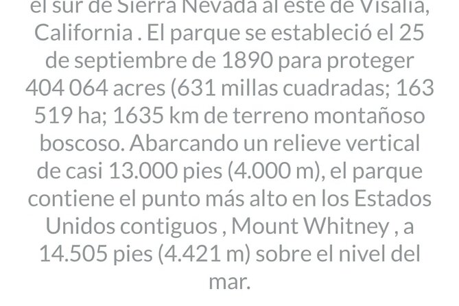
The Arizona section links the Desert Discovery Center, Grand Canyon National Park, Monument Valley, Bryce Canyon, Zion, Antelope Canyon, and Horseshoe Bend. This is where the app becomes more useful for trip planning than for a single attraction.
The Desert Discovery Center is listed as a short, 10-minute stop. Its focus is a meteorite that fell thousands of years ago. That makes it a quick educational pause rather than a major half-day visit. The app can help you fit it into a longer driving day, but the short suggested duration tells you not to build an entire day around it.
The Grand Canyon route covers its viewpoints. The listed visit is one hour, with no admission ticket included in the price. The route can help you organize a viewpoint drive and audio commentary, but you should remember that the national park itself may have entry requirements or charges. Those are separate from the app.
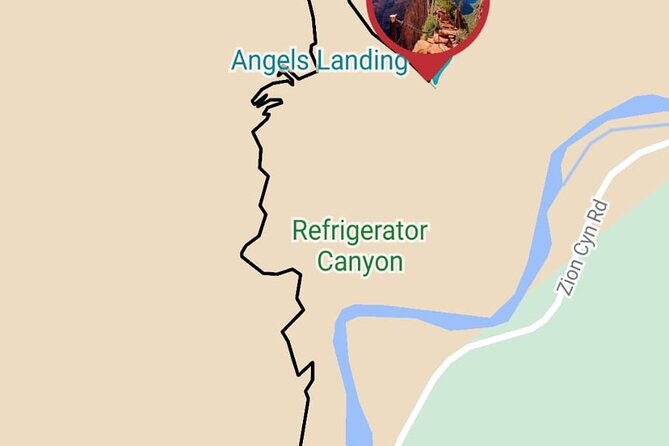
The Antelope Canyon material includes both driving and walking routes. It also connects the wider Arizona circuit with Monument Valley, Bryce Canyon, Zion, and Horseshoe Bend. This is valuable because these places are often planned as separate stops, yet they work better when arranged in a sensible road sequence.
Antelope Canyon is specifically marked as not including admission. That is one of the clearest extra-cost warnings in the itinerary. The app gives you the route and information, but it does not purchase an entrance ticket or provide another service at the site.
Las Vegas as a self-guided walking stop
Las Vegas is covered through a sightseeing route and walking directions to points of interest. The listed duration is one hour, and admission is shown as free.
That short time makes this section suitable for an introduction or a quick orientation. You can use it to locate the main points in the area rather than expecting a full account of every resort, show, museum, or neighborhood. The app’s strength here is practical: you can walk with the map open and listen as you go.
There is no promise of tickets, reservations, or entertainment access. If you want a show or paid attraction, you arrange and pay for it separately. This is a good example of how to use the product properly: let it organize your sightseeing, but do not mistake it for an all-inclusive Las Vegas package.
A different kind of day out around Los Angeles:
- Full-Day Iconic Sights of LA, Hollywood, Beverly Hills, Beaches and More
★ 5.0 · 6,147 reviews - Warner Bros. Studio Tour Hollywood
★ 4.5 · 5,246 reviews - Hollywood, Beverly Hills & Celebrity Homes Tour by Open Air Bus
★ 5.0 · 2,557 reviews - Hollywood Sign 2.5-Hour Tour with Comedians and Their Dogs
★ 5.0 · 2,496 reviews
Yosemite, with routes by car and on foot
The Yosemite section combines walking routes with a driving route from Mammoth Lakes to Oakhurst. That gives you two ways to use it. You can follow a route inside the park, or use the app as part of a larger road journey through the Sierra Nevada.
The listed visit is one hour and admission is shown as free. Again, that likely describes the suggested route length, not every possible Yosemite experience. Yosemite is too large to understand from one short walk, so use the audio route as an introduction and plan extra time if a particular viewpoint or trail appeals to you.
The Mammoth Lakes to Oakhurst route is especially useful for people building a point-to-point itinerary. Instead of treating Yosemite as an isolated destination, you can connect it with the next part of your trip. The app’s value grows when you use several linked sections rather than only one stop.
San Francisco, from Yosemite to the bay
The San Francisco material includes the route from Yosemite to San Francisco, walking routes through different neighborhoods, and possible excursions from the city. This is one of the strongest sections for an independent visit because San Francisco rewards walking, but its neighborhoods are spread across hills and busy streets.
The app can help you decide where to walk and how to connect those areas. The audio guide gives you something to listen to while moving, while the map links help you stay oriented. A separate excursion from San Francisco is also listed, although admission is not included for that portion.
Do not expect a local guide to adjust the route in real time. You choose the start, the pace, and the stops. That is a benefit if your group wants freedom, but it puts the responsibility for timing on you. One useful way to handle it is to select one neighborhood walk in the morning, then use the driving route or a separate excursion later.
Carmel and Monterey, with Silicon Valley on the way
The route from San Francisco to Carmel passes through Silicon Valley and points connected with companies such as Google and Facebook. This gives the drive a modern technology focus before it reaches the Monterey Peninsula.
The Carmel section also includes a walking tour of Monterey, a peninsula tour, and points of interest along the way. The listed duration is one hour, with no admission ticket shown. That makes it suitable for a quick introduction to the area, though not a complete visit to every coastal town or attraction.
I like this combination because it links very different parts of the journey. You can move from San Francisco’s neighborhoods to technology sites, then continue toward Monterey’s coastal area without searching for separate route material. The limitation is that the app does not provide any other service, so you still handle fuel, transport, meals, parking, and attraction tickets yourself.
Big Sur, Santa Barbara, and the coast to Santa Monica
Big Sur receives a dedicated route covering its points of interest, with about 30 minutes suggested. That is enough for a short orientation along this famous coastal stretch, but you should not read it as a complete day plan. Big Sur is best used at a relaxed pace, with time for viewpoints and stops that catch your attention.
The route then continues from Monterey toward Santa Barbara, passing through Solvang. Santa Barbara has its own attractions, and the section is also listed at about 30 minutes. Solvang adds a distinct stop between the Monterey area and Santa Barbara, making the route more than a simple turn-by-turn drive.
The final coastal section runs from Santa Barbara to Santa Monica. It points out places of interest and viewpoints along the coast. Since the route is listed at 30 minutes, use it as a guide to the main points, then add your own time for stops. The app can help you avoid missing the broad outline of the coast, but it cannot predict how long your group will spend at each view.
Audio languages and the web planning panel
The six audio languages are a practical advantage for mixed-language groups. You can listen in English, Spanish, Portuguese, German, Italian, or French, rather than relying only on written map labels. The available languages make the app easier to share among family members or friends who prefer different forms of commentary.
The web panel adds a second layer. You can customize your own route and use the panel as a repository for travel documents. This matters on a long trip, where your plans may include several parks, cities, and driving days. Keeping route choices and documents together can reduce the need to switch between several planning tools.
The app is particularly suited to people who like to prepare before departure. Feedback about the San Francisco route describes it as detailed and effective, and the family-planning comments point to a real benefit: you can shape the trip around your own interests instead of following a rigid schedule.
What is not included, and what you should budget for
The price covers the navigation app and its self-guided routes. It does not include any other service. That means you should not assume that entrance tickets, transport, meals, parking, accommodation, or special excursions are part of the cost.
Antelope Canyon and excursions from San Francisco are specifically marked as not including admission. The Grand Canyon and other stops show no admission ticket in the itinerary, but you should still check the rules and charges for the places you plan to enter. The app price should be treated as a planning and audio-guide fee, not as your complete sightseeing budget.
The non-refundable policy also deserves attention. Once booked, the experience cannot be changed or refunded for any reason. Because the route library covers a wide area, check your dates, language choice, and intended sections before paying.
The activity is private in the sense that only your group participates. That does not mean a private vehicle or private human guide is supplied. You are using the app with your own transport and your own party.
Who should use this route app?
I would recommend it most strongly to self-directed road trippers who want structure without a fixed tour. It suits families, couples, and small groups who are comfortable using a phone for directions and deciding how long to spend at each stop.
It is also a good fit for anyone planning several sections of the West Coast. The $34.39 group price becomes more useful when you use the Los Angeles, Arizona, Nevada, national park, San Francisco, and coastal material across a longer itinerary.
You may want something else if you need a live guide, a driver, included tickets, or a tightly timed one-day tour. The app will not remove the need to plan distances, check opening details, or manage your own transport.
Should you book it?
Book this app if you want a flexible road-trip framework and expect to use more than one route. Its best features are the large geographic coverage, six audio languages, Google Maps links, and the ability to build a custom itinerary. For a group of up to five, the price is fair when spread across several days.
Skip it if you only want a short, fully hosted Los Angeles excursion. The material covers too much territory to be a realistic one-day sightseeing plan, and the non-refundable policy leaves little room for a change of plans. Used as a digital road-trip companion, it can save planning time. Used as an all-inclusive tour, it will leave important gaps.
FAQ
Where does the activity start?
The stated start point is Los Angeles International Airport, at 1 World Way, Los Angeles, California 90045. The start time is 8:00 am.
Where does the activity end?
The activity ends back at the meeting point, Los Angeles International Airport.
How long does the experience last?
The approximate duration is 8 to 10 hours. The app includes route material for many destinations, so you should not expect to visit every listed stop within that time.
How many people can use one booking?
The price of $34.39 covers one group of up to five people.
Which languages are available for the audio guide?
Audio guides are available in Spanish, Portuguese, German, Italian, French, and English.
Are attraction tickets included?
No. The app includes self-guided routes and points of interest, but no other service. Admission for Antelope Canyon and excursions from San Francisco is specifically not included.
Just added around Los Angeles
- Photo Tour of Los Angeles for Social Media★ 5.0 · 11 reviews
- Pacific Coast Highway: Smartphone Audio Tour, LA to Santa Maria★ 4.0 · 13 reviews
- Pasadena Puzzle Adventure: Stop the Bomb!★ 3.5 · 5 reviews
- Outdoor Escape Room in LA – Little Tokyo★ 5.0 · 7 reviews
- 3.5-Hour LA Story Tour: Our Most Popular Los Angeles Tour!★ 5.0 · 4 reviews
- 2 Day Beginner Surf Adventure★ 5.0 · 26 reviews
- Getty Center Tours for KIDS and FAMILIES!★ 5.0 · 5 reviews
- Private 3-Hour Hollywood to Beverly Hills Tour★ 5.0 · 5 reviews
Los Angeles Self-Guided Audio Tours, compared.


City Sightseeing Hop-On Hop-Off Bus Tour with Audio Guide
Read our review →
30-Minute Luxury Driving Tour: Explore Hollywood in a Ferrari
Read our review →
50-Minute Driving Tour: Explore Hollywood Sign in a Ferrari
Read our review →
30-Minute Driving Tour: Explore Hollywood in a Lamborghini
Read our review →
1-Hour Driving Tour from Hollywood to Beverly Hills in a Ferrari
Read our review →
20-Minute Driving Tour: Hollywood to Sunset Blvd in a Lamborghini
Read our review →
50-Minute Driving Tour: Explore Los Angeles in a Lamborghini
Read our review →Browse the lists this tour appears in